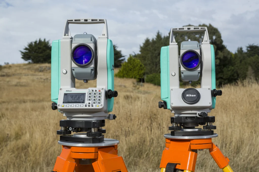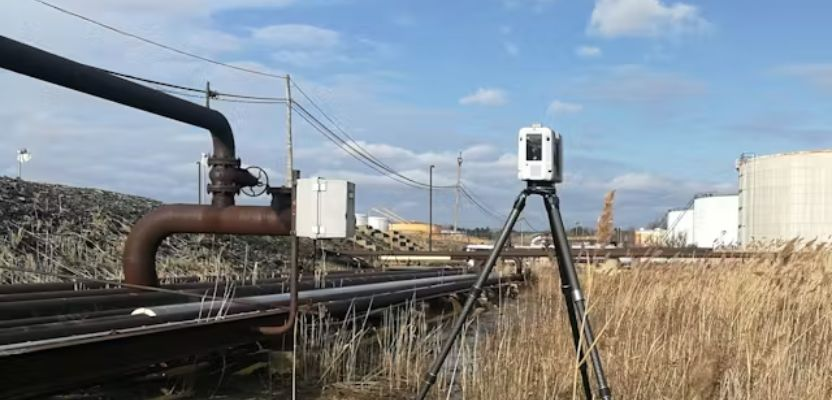
Choosing among the best land survey companies UAE has to offer requires more than comparing quotations or searching for the nearest survey crew.
Accurate land data can affect property boundaries, architectural design, excavation, road alignment, drainage levels, building positioning and final authority approvals. An error made during the surveying stage can therefore affect several later phases of a development.
Land surveying in the UAE also operates within emirate-specific regulatory systems. Dubai Municipality lists Law No. 6 of 2017 concerning the regulation of land-surveying works in Dubai and operates a dedicated Survey Department. Dubai Land Department separately maintains a current list of accredited surveying companies for specified real-estate survey services.
Clients should therefore distinguish between general engineering surveying and surveys that require a particular authority’s accreditation.
This guide identifies 10 currently operating UAE companies with verifiable land-survey capabilities. The numbering is an editorial selection designed to make comparison easier; it is not an independently audited performance ranking from first to tenth.
How We Selected the Best Land Survey Companies in the UAE
The selection focuses specifically on companies whose published services demonstrate genuine land-survey capability.
Relevant services included:
- Topographical surveying
- Boundary and demarcation surveys
- Construction setting-out
- As-built surveys
- Cadastral-related surveying
- Survey control and benchmarks
- Route and corridor surveys
- Digital terrain modelling
- Earthwork and volume surveys
- GNSS and total-station surveying
- Utility mapping where relevant to land development
- UAV and LiDAR surveying when used for land mapping
Companies were not included merely because they provide property valuation, quantity surveying or generic engineering consultancy.
We prioritized official company websites and current UAE government sources. Where a company itself claims a particular approval or certification, clients should independently confirm that credential remains valid before relying on it for an authority submission.
Top 10 Land Survey Companies in the UAE
1. Falcon Survey Engineering Consultants
Falcon Survey Engineering Consultants is a specialist UAE surveying company with a particularly broad land-survey portfolio.
Its dedicated land-survey division lists construction layouts, topographical surveys, boundary work, subdivision-related surveys and surveys supporting pipelines and land development.
Falcon’s topographical service captures property boundaries, structures, roads, levels, utilities, vegetation and other physical features, with deliverables compatible with platforms including CAD, Revit and GIS.
The company also provides construction surveying for setting-out and project control.
Key Land Survey Services
Falcon’s documented services include topographic surveys, boundary and demarcation work, construction layout, as-built surveys, land-development surveys, aerial mapping and related engineering-survey services.
Why It Stands Out
Breadth is Falcon’s main advantage.
A project can begin with an existing-condition topographical survey and later require construction setting-out, as-built verification, drone mapping or laser scanning. Falcon provides several of these disciplines within the same surveying organization.
The company states that it was established in 2007.
Contact and Coverage
Falcon’s Dubai office is in Apricot Tower, Dubai Silicon Oasis. Its current contact information also lists telephone contacts for Abu Dhabi and Ajman operations.
Official website: falconsurveyme.com
2. Al Warqa Survey Engineering
Al Warqa Survey Engineering is a strong option for projects requiring land surveying together with authority-related engineering-survey services in Dubai.
Its dedicated land-survey service covers residential, commercial and infrastructure work. The company states that its Dubai operation holds active Dubai Municipality registration as well as TRAKHEES and Dubai Development Authority approvals. Those credentials should still be checked for the particular project and activity before appointment.
Its wider services include topographical surveys, plot demarcation, GNSS and total-station surveying, setting-out, GPR, drone work and progress monitoring.
Key Land Survey Services
Relevant offerings include land surveys, topographic surveys, plot demarcation, setting-out, total-station surveys, GNSS positioning, as-built surveys and construction-related engineering surveying.
Why It Stands Out
Al Warqa is particularly relevant to Dubai projects where authority requirements form an important part of the surveying brief.
The company’s published information explicitly discusses different approval environments rather than treating every UAE land survey as identical.
It also maintains both Dubai and Abu Dhabi operations, which can help clients managing developments in more than one emirate.
Contact and Coverage
Al Warqa Survey Engineering is based in Al Qusais, Dubai. Al Warqa Survey Works LLC is listed in Mussafah, Abu Dhabi.
Official website: alwarqasurvey.com
3. Accurate Survey Engineering
Accurate Survey Engineering is a UAE surveying group headquartered in Sharjah with additional operating presence in Dubai and Abu Dhabi.
Its topographical survey services cover land mapping, contours, elevations, structures, roads, drainage, utilities and other site information used for construction and infrastructure planning.
The company’s broader land-survey information also identifies boundary surveys, construction layout, as-built surveys and route surveys among commonly undertaken surveying disciplines.
Key Land Survey Services
Accurate’s published capabilities include topographic surveys, demarcation, construction stake-out, as-built surveying, control work, UAV surveys, 3D laser scanning, utility detection and earthwork-related measurements.
Why It Stands Out
Accurate combines conventional land-survey services with newer technologies such as GNSS, drone surveying and 3D scanning.
That mix can be useful on developments where the same site information needs to support planning, engineering, construction and digital modelling.
Its website also maintains a dedicated authority-services division in addition to general and specialized surveying.
Contact and Coverage
Accurate Group lists its headquarters at Al Reem Building in Sharjah, alongside a Dubai operation and an Abu Dhabi group presence.
Official website: accuratesurvey.ae
4. Capital Surveys
Capital Surveys is an Abu Dhabi-headquartered company with an established specialization in land surveying.
The company states that it was founded in 1996 and originally operated as a specialized land-survey firm serving the oil and gas sector before expanding into a wider surveying and geotechnical business.
Its dedicated land-survey division provides one of the most detailed service menus in this comparison. It includes land surveying and levelling, topographical surveys, corridor alignment, cadastral and boundary surveys, demarcation, construction setting-out, digital terrain modelling, earthwork volumes, as-built surveys and establishment of control stations and benchmarks.
Key Land Survey Services
Capital Surveys provides topographic, cadastral, boundary, demarcation, setting-out, corridor, control, earthwork, utility and as-built surveys.
Why It Stands Out
The company’s land-survey service is unusually comprehensive and clearly defined.
Capital Surveys may be particularly suitable where an infrastructure or industrial project requires land surveying together with utility, geotechnical or subsurface information. Its wider business includes soil investigation, geophysical work and utility surveying.
Contact and Coverage
Capital Surveys’ head office is in Mohamed Bin Zayed City, Abu Dhabi. It also lists a Dubai branch in Al Barsha 1.
Official website: capital-surveys.com
5. Professional Survey Engineering Consultancy
Professional Survey Engineering Consultancy is an Abu Dhabi-based specialist whose business is strongly centered on engineering and land surveying.
The company states that it was established in 2011 and works on infrastructure, construction and development projects across Abu Dhabi, Dubai, Sharjah and the wider UAE.
Its current service portfolio includes topographical surveys, boundary and demarcation surveys, as-built surveys, GPS surveying, digital terrain modelling, monitoring and numerous other surveying activities.
Key Land Survey Services
Professional Survey provides topographic, boundary and demarcation, as-built, GPS, check, update, monitoring, pipeline and digital-terrain surveys.
The company specifically states that it is licensed to provide demarcation and boundary survey services. Prospective clients should confirm that this license covers the relevant authority and current project requirements.
Why It Stands Out
Professional Survey’s strongest appeal is its concentration on engineering-survey work rather than unrelated construction services.
It also publishes gate-level computation services associated with Dubai Municipality requirements, making it relevant for certain building-development survey scopes beyond its Abu Dhabi base.
Contact and Coverage
The company’s UAE office is in Konio Auto Building, Mussafah, Abu Dhabi.
Official website: professional-surveys.com
6. Takhteet Survey
Takhteet Survey operates from Sharjah and Dubai and specializes in land and engineering surveying.
The company states that it was founded in 2015 and expanded its surveying services in 2016, with land and engineering surveys for infrastructure becoming a core area of specialization.
Its current website describes land surveying alongside construction layout, mapping and digital survey services.
Key Land Survey Services
Takhteet’s documented land-related work includes boundary surveys, topographical surveys, construction layout, structural as-built surveying and modern mapping techniques involving UAVs and LiDAR.
Why It Stands Out
Takhteet is particularly suitable to consider where conventional surveying needs to connect with digital deliverables.
Its services increasingly combine field land surveys with drone mapping, LiDAR, 3D scanning and digital modelling, which can be useful for large developments and infrastructure projects.
Contact and Coverage
Takhteet lists its Sharjah office in Golden Tower, Al Majaz 1, and a Dubai branch at Green Space Business Center in Ras Al Khor Industrial Second.
Official website: takhteetsurvey.com
7. Global Maps Survey Services
Global Maps Survey Services is an Abu Dhabi-based surveying company with a dedicated land-survey operation.
Its current corporate website separates land surveys from aerial, marine, scanning, utility and monitoring services, demonstrating that conventional land surveying remains a distinct part of its business.
The company’s recent land-survey guidance identifies topographic, boundary and engineering surveys among the core services required for construction, infrastructure and real-estate development.
Key Land Survey Services
Global Maps provides land and topographical surveys, boundary work, engineering surveys, control-related work, mapping and related geospatial services.
It also offers utility mapping and aerial surveying when broader site information is required.
Why It Stands Out
The company can be useful for infrastructure projects in which the land survey needs to connect with utilities or aerial mapping rather than being delivered as an isolated plot plan.
Global Maps also states that it is ISO 9001:2015 certified. Clients requiring this credential for procurement should request the current certificate and scope during prequalification.
Contact and Coverage
Global Maps Survey Services is based in Mussafah M9, Abu Dhabi.
Official website: globalmapsurvey.com
8. UPG Surveying
UPG Surveying is an Abu Dhabi-based surveying and geospatial company providing topographical land-survey services for construction and infrastructure projects.
Its current topographic service covers site mapping and terrain information used for planning and design. Published applications include transportation corridors, power infrastructure, industrial projects and land-development environments.
Key Land Survey Services
UPG provides topographical mapping, construction surveying, aerial mapping, 3D laser scanning, utility mapping and GIS-related services.
Its topographic work includes terrain data, route alignment and site mapping for engineering applications.
Why It Stands Out
UPG is particularly relevant for Abu Dhabi projects requiring land-survey data to feed into broader engineering or geospatial analysis.
Its service mix is also appropriate for projects where conventional topography needs to be supplemented by drone surveys, utility data or GIS.
Contact and Coverage
UPG lists its registered office in Al Danah, Zone 1, Abu Dhabi.
Official website: upgsurveying.com
9. Beehive Engineering Consultancy
Beehive Engineering Consultancy is an Abu Dhabi business providing land surveying alongside engineering and building-related services.
The company describes topographic land surveying as a core service and specifically lists topographic, boundary and construction surveys within its UAE offering.
Its published technical information also identifies boundary and cadastral surveys, topographic and contour surveys, construction layout and monitoring among the land-survey services available.
Key Land Survey Services
Beehive’s documented survey capabilities include topographical mapping, boundary and cadastral surveying, construction layout and monitoring, underground utility detection and related digital survey work.
Why It Stands Out
Beehive is particularly relevant to clients seeking a land-survey provider centered on Abu Dhabi.
Its combination of boundary, topographic and construction surveys means it can be considered across different stages of property and infrastructure development rather than for topography alone.
Contact and Coverage
The company’s current contact information identifies its base in Mussafah, Abu Dhabi.
Official website: beehive-engineering.com
10. EIWAA Consultancy
EIWAA Consultancy provides engineering and digital surveying services in the UAE, including a dedicated land survey and GPS-survey offering.
Its published engineering-survey services include topographical surveys, land and GPS surveys, site mapping and total-station work.
The company also combines conventional field surveying with terrestrial LiDAR, 3D laser scanning and as-built documentation.
Key Land Survey Services
EIWAA provides topographical surveying, land and GPS surveys, demarcation and boundary-related work, setting-out, terrain mapping and digital survey services.
Why It Stands Out
EIWAA may be useful where a client requires both conventional survey information and digital documentation.
Its ability to combine land surveying with LiDAR and 3D scanning is particularly relevant for industrial, engineering and existing-site projects where detailed as-built data is required.
Contact and Coverage
EIWAA lists UAE contact operations, including a Sharjah telephone contact, as part of its wider regional business.
Official website: eiwaaconsultancy.com
Top 10 Land Survey Companies in the UAE Compared
| Company | Main UAE Location | Key Land Survey Services | Potential Project Fit |
|---|---|---|---|
| Falcon Survey Engineering Consultants | Dubai | Topographic, boundary, construction layout, demarcation, as-built | Broad property and infrastructure projects |
| Al Warqa Survey Engineering | Dubai | Land survey, plot demarcation, topography, setting-out, as-built | Dubai development and authority-related work |
| Accurate Survey Engineering | Sharjah | Topographic, demarcation, stake-out, as-built, control | Construction and infrastructure |
| Capital Surveys | Abu Dhabi | Cadastral, boundary, topographic, setting-out, corridor, control | Large land and infrastructure projects |
| Professional Survey Engineering Consultancy | Abu Dhabi | Boundary, demarcation, topographic, GPS, as-built, DTM | Property and engineering projects |
| Takhteet Survey | Sharjah/Dubai | Boundary, topographic, construction layout, LiDAR | Land development and digital surveys |
| Global Maps Survey Services | Abu Dhabi | Land, boundary, topographic and engineering surveys | Abu Dhabi infrastructure and development |
| UPG Surveying | Abu Dhabi | Topographical mapping, construction survey, GIS | Engineering and infrastructure |
| Beehive Engineering Consultancy | Abu Dhabi | Topographic, boundary, cadastral, construction | Property and construction projects |
| EIWAA Consultancy | UAE operations | Land, GPS, topographic, setting-out, mapping | Engineering and industrial surveying |
This comparison summarizes publicly documented capabilities rather than independent performance scores. Specific authority acceptance should always be confirmed for the particular transaction or project.
How to Choose the Right Land Survey Company in the UAE
Verify the Required Authority Approval
This should be one of the first questions asked.
Dubai Municipality maintains specific regulation for land-surveying works and a Survey Department responsible for surveying systems and services.
Dubai Land Department also maintains a separate list of accredited surveying companies for DLD-related real-estate survey services. A company being competent at construction topography does not automatically mean it appears on the DLD list for a particular property-survey transaction.
Ask the survey firm exactly which authority approval your proposed survey requires.
Define the Survey Type Before Requesting Prices
Do not simply ask for “a land survey.”
Specify whether you require:
- Boundary or demarcation survey
- Topographical survey
- Construction setting-out
- As-built survey
- Cadastral-related survey
- Route or corridor survey
- Level survey
- Control-point establishment
- Earthwork or volume survey
These services involve different fieldwork, accuracy requirements and deliverables.
Establish the Required Coordinate System
Survey data must use the coordinate-reference system required by the project and relevant authority.
For Dubai projects, the Dubai Virtual Reference Station provides high-accuracy positioning for surveying, construction, GIS and positioning applications, with Dubai Municipality stating that the system can provide sub-centimeter positioning.
A professional survey scope should state the applicable grid, datum and benchmarks rather than leaving these details ambiguous.
Compare Accuracy, Not Just Price
A low-cost survey is of little value if it does not satisfy the designer’s tolerances.
Different applications can require very different levels of precision. Boundary establishment, structural setting-out and deformation monitoring generally demand different methodologies from preliminary large-area terrain mapping.
Request the required horizontal and vertical accuracy in writing.
Check the Company’s Land-Survey Experience
Ask for recent work comparable with your proposed project.
A survey company experienced mainly in villas may not be the strongest choice for a 20-kilometre road corridor. Equally, a specialist infrastructure surveyor may be unnecessary for a straightforward residential plot.
Experience should match the scale, land conditions and deliverables involved.
Confirm the Equipment and Methodology
Modern land-survey companies may use a combination of:
- GNSS receivers
- Robotic total stations
- Digital levels
- UAV photogrammetry
- LiDAR
- Terrestrial laser scanners
- Ground-penetrating radar
Technology should be selected according to the project rather than for marketing value.
A drone can map a large area efficiently, while a total station may be more appropriate for precise construction setting-out.
Ask What Is Included in the Deliverables
Before appointment, specify whether the price includes items such as:
- Signed survey report
- CAD drawing
- PDF plan
- Coordinates
- Contours
- Digital terrain model
- Benchmark schedule
- Point cloud
- Orthophoto
- GIS files
- Authority submission
- Revisions following authority comments
This makes quotations much easier to compare fairly.
Verify Boundaries Carefully
A boundary survey carries different implications from a normal topographical survey.
Topographical surveys record terrain and existing physical features, while boundary or cadastral work deals with legal property limits and official records.
Where ownership or encroachment is involved, make sure the company is authorized to perform the required survey and that the deliverable will be recognized by the relevant authority.
Consider Utility Mapping Before Excavation
Land surveying records what is visible above ground, but existing underground services can create additional risks.
For developed sites, it may be sensible to combine the conventional survey with utility detection or mapping when excavation forms part of the proposed works.
Several companies in this guide provide both surface surveying and underground-utility services.
Frequently Asked Questions
Which are the best land survey companies in UAE?
Falcon Survey Engineering Consultants, Al Warqa Survey Engineering, Accurate Survey Engineering, Capital Surveys, Professional Survey Engineering Consultancy, Takhteet Survey, Global Maps Survey Services, UPG Surveying, Beehive Engineering Consultancy and EIWAA Consultancy all provide verifiable land or topographical survey services in the UAE.
The most appropriate firm depends on the emirate, survey type, authority requirements and project scale.
Read Also: Land Survey Companies in the United States
Which land survey company should I use in Dubai?
There is no universal answer.
For engineering land surveys, companies such as Falcon, Al Warqa, Accurate and Takhteet have documented Dubai operations or services.
For an authority-specific transaction, first identify which authority will accept the survey. Dubai Land Department, for example, publishes its own list of accredited surveying companies for relevant DLD services.
Which land survey companies operate in Abu Dhabi?
Capital Surveys, Professional Survey Engineering Consultancy, Global Maps Survey Services, UPG Surveying and Beehive Engineering Consultancy are all based in Abu Dhabi.
Falcon and Al Warqa also publish Abu Dhabi operating contacts.
What is a topographic land survey?
A topographic survey measures the location and elevation of features across a site.
The resulting plan can include contours, spot levels, buildings, walls, roads, utilities, drainage features, vegetation and other existing conditions.
The information is commonly used by architects and engineers to design buildings, roads, drainage and other infrastructure. Falcon and Accurate both provide detailed descriptions of this type of surveying.
What is a boundary survey?
A boundary survey establishes or verifies the limits of a parcel of land.
It differs from a basic topographical survey because the focus is on property boundaries rather than simply recording terrain and physical features.
Professional Survey specifically provides demarcation and boundary services, while Capital Surveys lists cadastral, boundary and demarcation surveying within its land-survey department.
What is construction setting-out?
Setting-out transfers positions and dimensions from engineering or architectural drawings onto the physical construction site.
Surveyors establish the location of elements such as buildings, columns, roads, foundations and utilities so contractors can construct them in the designed position.
Falcon, Capital Surveys and Accurate are among the companies in this guide that document construction-layout or setting-out capability.
How much does a land survey cost in the UAE?
There is no reliable universal price for a UAE land survey.
The quotation depends on the area of the site, survey type, required accuracy, accessibility, authority requirements, number of survey points, existing development and the required final deliverables.
For a meaningful comparison, send the same survey scope and drawings to several qualified firms rather than requesting a generic price for “land surveying.”
How can I verify a land survey company in Dubai?
For land-surveying activity, check the company’s applicable Dubai licensing or qualification and confirm the specific approval required for your work. Dubai Municipality publishes legislation governing land-surveying works and information relating to engineering companies and practice requirements.
If the task is a Dubai Land Department real-estate survey service, DLD provides a current online list of accredited surveying companies.
Final Thoughts
The strongest land survey companies UAE clients should consider are those that match the actual survey requirement rather than simply offering the longest list of technologies.
Falcon Survey Engineering Consultants provides a particularly broad combination of land and construction surveying. Al Warqa combines land-survey work with a strong Dubai authority focus, while Accurate brings together traditional surveying and newer geospatial techniques.
Capital Surveys has one of the most comprehensive documented land-survey service portfolios, including cadastral, boundary, topographic, corridor, construction and control work. Professional Survey provides a similarly focused engineering-survey offering from Abu Dhabi.
Takhteet is worth considering for projects combining land surveying with LiDAR and digital workflows, while Global Maps, UPG and Beehive provide additional Abu Dhabi-focused alternatives. EIWAA combines land and GPS surveying with digital scanning capabilities.
Before appointing any company, confirm current authority approvals, the precise survey scope, coordinate system, accuracy requirements, deliverables and whether the survey will be accepted by the authority or consultant for whom it is being prepared.
For land surveying, accurate data and regulatory acceptance matter considerably more than choosing a company simply because it appears first in a search result.
Read Also: 10 Best Bridge Contractors in the UAE for Major Infrastructure Projects