The best surveyors in UAE support almost every stage of property development and infrastructure construction, from establishing boundaries and existing ground levels to setting out buildings, recording completed structures and creating detailed digital models.
Modern surveying in the Emirates also extends well beyond conventional total-station measurements. Depending on the project, firms now provide GNSS control surveys, drone photogrammetry, LiDAR, terrestrial 3D laser scanning, underground utility detection, GIS data collection, hydrographic surveys and structural monitoring.
The regulatory requirements matter as much as the technology. Dubai has specific legislation regulating land-surveying works, while Dubai Municipality operates its Survey Department and Dubai Virtual Reference Station network for high-accuracy positioning. Abu Dhabi’s Department of Municipalities and Transport also maintains engineering classification systems that include land-surveying consultancy activities.
This guide focuses primarily on land, engineering and geospatial survey companies rather than quantity surveyors or property valuation firms. The numbering is an editorial selection for navigation and comparison; it is not an independently audited ranking from first to tenth.
How We Selected the Best Surveyors in the UAE
Companies were considered based on verifiable evidence that surveying forms a meaningful part of their current UAE operations.
Priority was given to firms offering services such as topographical surveys, boundary and demarcation surveys, construction setting-out, as-built surveys, control networks, 3D laser scanning, aerial mapping, underground-utility surveys, GIS, monitoring or hydrographic surveying.
We also considered geographic coverage, range of surveying technologies, specialization, publicly documented operating history and whether the firm publishes enough technical information for a prospective client to understand what it actually does.
For regulated or authority-related survey work, clients should still verify that the firm and individual professionals hold the current approvals required for their particular project. Dubai Municipality publishes information concerning surveying regulation and engineering qualification, while Abu Dhabi maintains searchable engineering-classification resources.
Read Also: The Best Surveyors in the UAE
Top 10 Surveyors in the UAE
1. Falcon Survey Engineering Consultants
Falcon Survey Engineering Consultants is one of the more comprehensive specialist surveying firms operating in the Emirates. The company says it was established in 2007 and currently maintains UAE offices in Dubai, Abu Dhabi, Ajman and Ras Al Khaimah.
Its service portfolio covers conventional land surveying as well as mobile mapping, aerial mapping, engineering surveys, construction surveys, 3D laser scanning, building surveys and bathymetric work. Its land-survey operation includes topographical, boundary, subdivision, construction-layout and pipeline-related surveys.
Key Services
Falcon provides topographical surveys, construction setting-out, boundary work, mobile mapping, aerial and drone mapping, 3D laser scanning, as-built surveying and other engineering-survey services.
Why It Stands Out
The main advantage is breadth. A developer that begins with a conventional topographical survey and later requires construction control, laser scanning or digital mapping can potentially source several related disciplines from the same surveying business.
Falcon’s multi-emirate office network may also be useful for companies managing projects in several parts of the UAE.
Contact and Coverage
Falcon’s head office is in Dubai Silicon Oasis, with branches listed in Abu Dhabi, Ajman and Ras Al Khaimah.
Official website: falconsurveyme.com
2. Al Warqa Survey Engineering
Al Warqa Survey Engineering is a Dubai-based surveying and geospatial firm with operations in Dubai and Abu Dhabi. Its current corporate profile describes services covering land, aerial, subsurface, marine and aeronautical surveying.
The company also publishes a broad technical offering including boundary and topographic surveys, drone photogrammetry, 3D laser scanning, GIS, GPR surveys, setting-out, progress monitoring and other engineering-survey activities.
Key Services
Relevant services include land surveying, topographical surveys, plot demarcation, construction setting-out, GNSS and total-station work, drone surveys, 3D laser scanning, GIS and ground-penetrating radar.
Why It Stands Out
Al Warqa is particularly useful to consider when a project requires both traditional survey control and newer digital geospatial methods.
Its website also identifies an Abu Dhabi operation in Mussafah alongside its Dubai base, while its careers information says the business works across all seven emirates.
Contact and Coverage
The company lists its Dubai operation in Al Qusais and an Abu Dhabi office in Mussafah.
Official website: alwarqasurvey.com
3. Accurate Survey Engineering
Accurate Survey Engineering Group began in Sharjah in 2006 and now describes a UAE operation comprising three companies across the Emirates. Its official information states that it has expanded from its original Sharjah business into a larger surveying organization with more than 200 professional employees.
Its services cover topographical surveys, construction stake-out, underground-utility detection, 3D laser scanning, mobile mapping, UAV surveying, control points, monitoring, as-built surveys and volumetric surveys.
Key Services
Accurate provides land and topographic surveys, stake-out work, LiDAR and 3D scanning, drone mapping, GPR and utility detection, structural and MEP as-built surveys, monitoring and digital mapping.
It also provides authority-related survey services such as Dubai Municipality gate-level computation and certain third-party and as-built verification work.
Why It Stands Out
The company has an unusually broad mix of construction-oriented survey services. This can make it relevant to developers and contractors that need surveying from initial site investigation through construction and final as-built documentation.
Its published technology portfolio includes mobile mapping, LiDAR, 3D scanners and bathymetry alongside traditional survey methods.
Contact and Coverage
Accurate Survey Group lists its head office in Sharjah and states that the business has expanded across the UAE.
Official website: accuratesurvey.ae
4. Capital Surveys
Capital Surveys is an Abu Dhabi-headquartered surveying and geotechnical company founded in 1996. It says the business began as a specialist land-surveying firm serving the oil and gas sector before expanding into integrated land, marine and geotechnical surveying.
Its land-survey department provides topographic surveys, corridor and alignment surveys, cadastral and boundary surveys, demarcation, construction setting-out, digital terrain modelling and control-related services.
Capital Surveys also provides hydrographic and marine surveying, geophysical surveys, 3D laser scanning and soil investigation.
Key Services
The company’s capabilities include land surveying, boundary and cadastral work, construction surveys, corridor surveys, hydrographic surveys, marine geophysics, 3D scanning and geotechnical investigation.
Why It Stands Out
Capital Surveys is particularly strong as an option where surveying interfaces with geotechnical or marine investigation.
A major infrastructure, offshore, port or coastal development may require more than simple surface coordinates. Having land, marine and subsurface capabilities within one organization can reduce the number of technical interfaces a client needs to manage.
Contact and Coverage
Capital Surveys lists its head office in Mohamed Bin Zayed City, Abu Dhabi, plus a Dubai branch in Al Barsha.
Official website: capital-surveys.com
5. Fugro
Fugro is different from many conventional land-survey companies on this list. It is an international Geo-data specialist whose UAE business is particularly relevant to large infrastructure, offshore, energy, marine and geotechnical projects.
Fugro’s UAE operation states that it provides integrated Geo-data, surveying and consulting services for offshore energy, infrastructure and industrial projects across the Gulf region.
Its technical capabilities include geotechnical surveys, offshore and marine surveying and wider Geo-data acquisition and interpretation.
Key Services
Fugro provides Geo-data acquisition, positioning and surveying alongside geotechnical and marine services. The exact scope is generally more specialized than the residential plot and construction-setting-out work associated with a traditional local land surveyor.
Why It Stands Out
Fugro is most relevant when the survey problem is technically complex: offshore developments, seabed and marine conditions, energy infrastructure, major transportation assets or projects where surveying and geotechnical information need to be interpreted together.
For a straightforward villa boundary survey, another company on this list may be a more natural fit. For major Geo-data programs, Fugro brings a substantially different level of specialization.
Contact and Coverage
Fugro Middle East FZE lists its UAE office in Jebel Ali Free Zone, Dubai.
Official website: fugro.com
6. Professional Survey Engineering Consultancy
Professional Survey Engineering Consultancy LLC is an Abu Dhabi-based specialist established in 2011. Its corporate profile says it provides engineering-survey solutions for infrastructure, construction and development projects in the UAE and wider Middle East.
The company’s published service list is extensive and includes topographical, hydrographic, as-built, boundary and demarcation, GPS, pipeline, 3D laser scanning, GPR, digital terrain modelling, monitoring and GIS data-collection services.
Key Services
Professional Survey offers topographical surveys, demarcation and boundary work, construction and as-built surveys, hydrographic surveys, GPS surveying, pipeline surveys, laser scanning, GPR, monitoring and GIS collection.
Its website specifically describes the company as licensed to provide demarcation and boundary surveying.
Why It Stands Out
The company is a strong option to investigate for Abu Dhabi-based construction and infrastructure work requiring a wide mix of conventional and specialist survey techniques.
The published scope is also broad enough to cover several phases of a project rather than just initial land measurement.
Contact and Coverage
Professional Survey Engineering Consultancy is based in Mussafah, Abu Dhabi, and states that it works in Abu Dhabi, Dubai, Sharjah and elsewhere in the UAE.
Official website: professional-surveys.com
7. Takhteet Survey
Takhteet Survey is a UAE surveying company operating from Sharjah and Dubai. Current company information states that the business began in 2015 and expanded its surveying activity from 2016, specializing in land and engineering surveys for infrastructure projects.
Its service portfolio has a strong digital component, including land surveying, LiDAR-equipped UAV work, aerial data collection, 3D laser scanning, structural as-built surveying, BIM modelling, underground-utility detection and hydrographic or bathymetric surveying.
Key Services
Takhteet provides land and construction surveys, drone and LiDAR mapping, 3D scanning, scan-to-BIM and structural as-built work, underground-utility surveys and hydrographic services.
Why It Stands Out
Takhteet is particularly relevant for digital survey workflows.
Projects involving renovation, complex structures or digital twins increasingly require survey data that moves beyond a two-dimensional CAD plan. Takhteet’s use of laser scanning, point clouds and BIM makes it worth comparing for these applications.
Contact and Coverage
The company lists a Sharjah office in Al Majaz and a Dubai operation in Ras Al Khor Industrial Second.
Official website: takhteetsurvey.com
8. Global Maps Survey Services
Global Maps Survey Services is an Abu Dhabi-based surveying business offering land, aerial, marine and specialist engineering-survey services.
Its current service menu includes land surveys, aerial surveys, marine surveying, terrestrial scanning, utility mapping, traffic surveys and monitoring.
The company also identifies pipeline and oil-field location surveys, construction layouts, topographical and boundary surveys, subdivision work and geodetic control among its areas of activity.
Key Services
Services include topographical and boundary surveys, construction layout, aerial mapping, marine and hydrographic surveying, terrestrial scanning, utility mapping, monitoring and geodetic-control work.
Why It Stands Out
Global Maps Survey may be particularly relevant to engineering, infrastructure and oil-and-gas clients because its stated capabilities extend from conventional land surveying into pipelines, utility mapping and marine surveys.
Its published information also identifies the company as ISO 9001:2015 certified.
Contact and Coverage
Global Maps Survey Services lists its office in Mussafah M9, Abu Dhabi.
Official website: globalmapsurvey.com
9. Al Bayanat Alalamya for Surveying Services
Al Bayanat Alalamya for Surveying Services LLC is an Abu Dhabi-based business combining surveying with GIS and wider geospatial services.
Its current corporate site lists geodesy and field surveying, aerial survey and image processing, hydrographic surveying, geospatial services and consulting among its core activities.
The firm also provides GIS and mapping-related services such as data preparation, remote sensing, geocoding and data conversion.
Key Services
Al Bayanat’s capabilities include field and geodetic surveying, aerial surveying, photogrammetry, hydrographic surveying, geophysical surveys, cartography and GIS.
Why It Stands Out
The company is particularly relevant where the required deliverable is not simply coordinates but a broader geospatial dataset.
Municipal planning, asset databases, large-area mapping and GIS integration can require data collection, processing and software-oriented geospatial services in addition to field surveying.
Contact and Coverage
Al Bayanat lists its corporate office in Baniyas, Abu Dhabi.
Official website: albayanat.ae
10. GEO SURVEY TECH
GEO SURVEY TECH is a geospatial surveying company offering land surveying alongside GIS, BIM, digital twins, drone mapping and 3D laser scanning.
Its official website lists land surveying, GIS, BIM, digital-twin services, drone mapping and 3D laser scanning as core services.
The company states that its wider team has more than 15 years of field experience and that it has operations or presence across the UAE and other GCC and Asian markets.
Key Services
The company’s current portfolio centers on land surveying, GIS, BIM, digital twins, drone mapping and laser scanning.
This makes it particularly relevant to projects seeking digital spatial data that can feed directly into design, BIM or asset-management workflows.
Why It Stands Out
GEO SURVEY TECH represents the increasingly digital side of the surveying market.
Traditional surveying establishes accurate positions; combining that information with BIM, GIS, scanning and digital-twin workflows can make the same spatial dataset useful during design, construction and subsequent asset operation.
Contact and Coverage
The company’s official site identifies its operations in the United Arab Emirates, while its corporate profile lists Dubai as its headquarters and an Abu Dhabi presence.
Official website: geosurveytech.com
Top 10 Surveyors in the UAE Compared
| Company | Main UAE Location | Key Survey Capabilities | Potential Project Fit |
|---|---|---|---|
| Falcon Survey Engineering Consultants | Dubai | Land, construction, mobile mapping, aerial, laser scanning, bathymetry | Broad construction and infrastructure surveys |
| Al Warqa Survey Engineering | Dubai | Land, GNSS, drone, GPR, laser scanning, GIS | Construction and multi-discipline geospatial work |
| Accurate Survey Engineering | Sharjah | Topographic, stake-out, LiDAR, mobile mapping, GPR, as-built | Construction and authority-related surveys |
| Capital Surveys | Abu Dhabi | Land, cadastral, marine, geophysical, geotechnical | Infrastructure, oil and gas, marine projects |
| Fugro | Dubai | Geo-data, offshore, marine and geotechnical surveys | Complex offshore and major infrastructure |
| Professional Survey Engineering Consultancy | Abu Dhabi | Topographic, boundary, hydrographic, GPR, GIS | Infrastructure and construction surveying |
| Takhteet Survey | Sharjah/Dubai | Land, LiDAR, UAV, 3D scanning, BIM, utilities | Digital surveying and as-built modelling |
| Global Maps Survey Services | Abu Dhabi | Land, aerial, marine, utility and monitoring | Infrastructure and oil-and-gas surveys |
| Al Bayanat Alalamya | Abu Dhabi | Geodesy, aerial, hydrographic, photogrammetry, GIS | Mapping and geospatial programs |
| GEO SURVEY TECH | Dubai/UAE | Land, GIS, BIM, digital twins, drone and scanning | Digitally integrated construction projects |
The comparison focuses on publicly documented capabilities and should be used as a starting point for procurement rather than a substitute for technical prequalification.
How to Choose the Right Surveyor in the UAE
Identify the Exact Type of Survey Required
“Surveying” covers several different professional activities.
A topographical survey records terrain and existing features. A boundary survey establishes property limits. Construction setting-out transfers design coordinates onto the site. An as-built survey records what was actually constructed.
Hydrographic surveys examine underwater conditions, while laser scanning creates dense three-dimensional point clouds.
Choose a company with documented experience in the precise discipline your project requires.
Verify Authority Acceptance
This is especially important when survey information will be submitted for planning, building or land approvals.
Dubai regulates land-surveying works and maintains government surveying infrastructure including the Dubai Virtual Reference Station network. The DVRS provides high-accuracy positioning data for surveying, GIS, construction and positioning applications.
For Abu Dhabi projects, check current DMT engineering classifications and confirm the activity under which the firm or consultant is permitted to operate.
Check the Required Accuracy
Not every survey requires the same precision.
A drone survey for large-scale terrain planning may have different accuracy requirements from high-rise structural monitoring, machine alignment or cadastral boundary work.
Before requesting quotations, specify the coordinate system, expected horizontal and vertical accuracy, control requirements and required deliverable format.
Ask What Equipment Will Be Used
Depending on the project, a survey company may deploy:
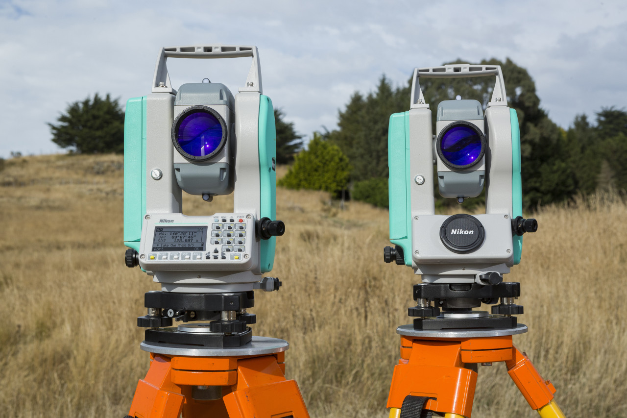
- Robotic total stations
- GNSS receivers
- Digital levels
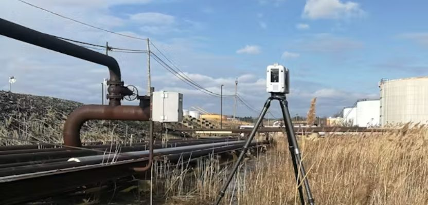
- Terrestrial laser scanners
- UAVs and LiDAR systems
- Ground-penetrating radar
- Mobile mapping systems
- Echo sounders and marine-survey equipment
The most advanced instrument is not automatically the correct one. The equipment should match the accuracy, environment and deliverable required.
Examine Survey Control
Reliable projects depend on a reliable control network.
Ask how the survey will be connected to official benchmarks or approved coordinate-reference systems and how control points will be checked.
Dubai Municipality’s DVRS infrastructure demonstrates the importance placed on accurate geodetic positioning in the emirate.
Review Deliverables Before Awarding the Work
Do not wait until the survey is complete to decide what files you need.
Confirm whether the contract includes:
- CAD drawings
- Coordinate schedules
- PDF survey plans
- Digital terrain models
- Point-cloud files
- Orthophotos
- GIS files
- Revit or BIM models
- Survey reports
- Photographic records
A cheaper quotation may become more expensive if important deliverables are excluded.
Check Experience With Similar Projects
A company that performs residential plot surveys may not be the right choice for offshore bathymetry.
Likewise, an offshore Geo-data specialist may be unnecessary for a straightforward building setting-out job.
Request recent projects comparable in size, environment and technical requirements.
Consider Underground Utility Detection
Existing services represent a major risk on developed sites.
Where excavation is planned, determine whether the project requires utility mapping using methods such as GPR or electromagnetic detection in addition to conventional surface surveying.
Several firms in this guide—including Accurate, Takhteet and Professional Survey—publish underground-utility or GPR capabilities.
Frequently Asked Questions
Which are the best surveyors in UAE?
There is no universal best surveying company for every project. Falcon, Al Warqa, Accurate, Capital Surveys, Fugro, Professional Survey, Takhteet, Global Maps Survey, Al Bayanat and GEO SURVEY TECH all publish verifiable surveying or geospatial capabilities in the UAE. The strongest choice depends on whether you need a land, construction, boundary, marine, utility, laser-scanning or geospatial survey.
How do I choose a land surveyor in Dubai?
Start by identifying the exact survey required and whether the deliverable needs authority approval. Check that the survey firm can work with the appropriate Dubai coordinate and control systems and verify any applicable professional or company approvals. Dubai Municipality maintains dedicated surveying services and regulates land-surveying work in the emirate.
What is a topographical survey?
A topographical survey records the horizontal and vertical position of natural and constructed features across a site.
Typical information can include ground levels, buildings, roads, walls, utilities and other visible features. The resulting survey is commonly used by architects and engineers during design and site planning. Falcon, Accurate and Capital Surveys are among the firms in this guide that explicitly offer topographical surveying.
What is the difference between a land survey and a 3D laser scan?
A traditional land survey normally establishes coordinates, boundaries, levels or selected site features using instruments such as GNSS receivers and total stations.
A 3D laser scanner captures very large numbers of measurement points to create a dense digital representation of a structure or environment. It can be particularly useful for complex buildings, plant, façades and as-built documentation.
Do I need a surveyor before starting construction?
Most serious construction projects require accurate survey information at several stages.
A survey may establish existing site conditions before design, provide control points and setting-out during construction, monitor movement and finally record the completed works through an as-built survey.
The exact regulatory and technical requirements depend on the development and emirate.
How much do surveying services cost in the UAE?
There is no reliable universal price because survey fees depend on site area, required accuracy, number of survey crews, accessibility, equipment, authority requirements and deliverables.
A small plot survey is fundamentally different from scanning a high-rise tower or carrying out an offshore hydrographic campaign.
For meaningful comparison, provide each shortlisted surveyor with the same scope, drawings, accuracy requirements and deliverable list.
What is a hydrographic survey?
A hydrographic survey measures underwater and coastal conditions such as water depth and seabed characteristics.
These surveys support ports, dredging, coastal developments, marine structures and offshore infrastructure. Capital Surveys, Falcon, Professional Survey, Global Maps Survey and Al Bayanat all publish hydrographic or marine-survey capabilities.
What should I ask a survey company before hiring it?
Ask about current licensing or authority acceptance where required, similar project experience, equipment, coordinate systems, required accuracy, control methodology, survey-team qualifications and turnaround.
Most importantly, specify exactly what you expect to receive. A technically accurate field survey can still create problems if the CAD, GIS, BIM or reporting deliverables do not match the consultant’s requirements.
Final Thoughts
The best surveyors in UAE vary considerably in specialization.
Falcon, Al Warqa and Accurate provide broad land and engineering-survey portfolios suitable for many construction and infrastructure requirements. Capital Surveys combines land surveying with marine and geotechnical capability, while Fugro is better positioned toward highly specialized Geo-data, offshore and large-infrastructure assignments.
Professional Survey and Global Maps Survey provide extensive Abu Dhabi-focused engineering-survey services, while Takhteet and GEO SURVEY TECH place greater emphasis on digital technologies such as LiDAR, BIM, scanning and digital geospatial workflows. Al Bayanat is particularly relevant where surveying must integrate with GIS, mapping or broader location-data systems.
Read Also: 10 Best Road Construction Companies in the UAE for Major Infrastructure Projects